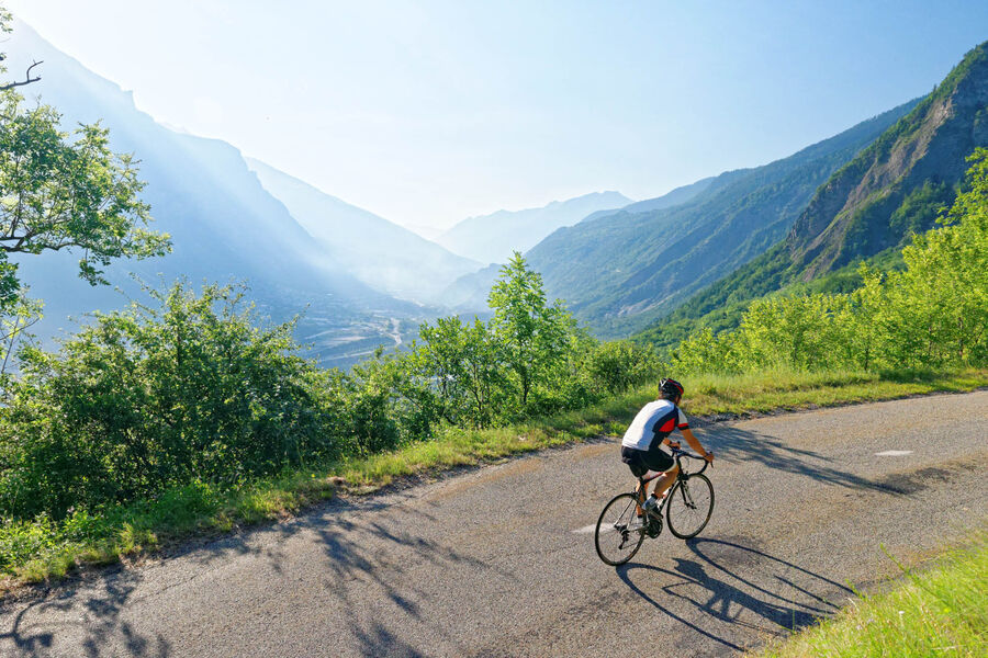
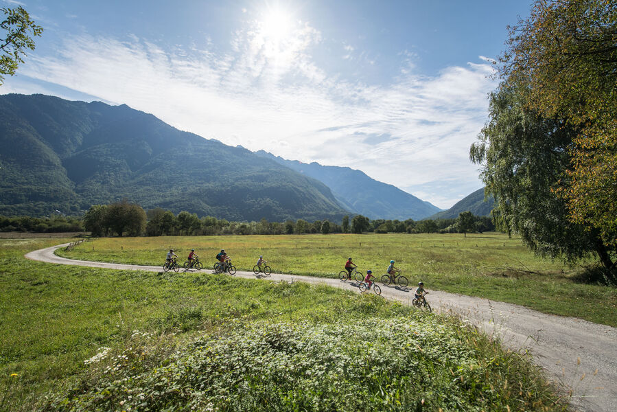
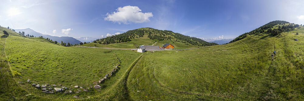
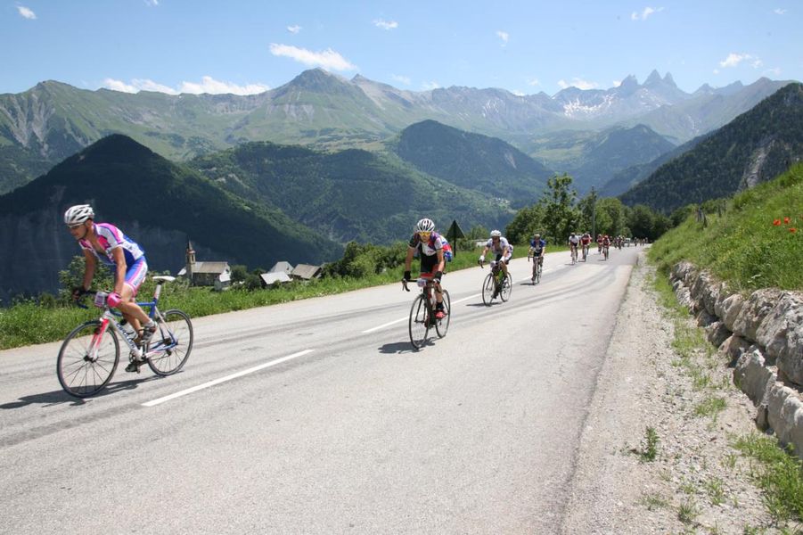
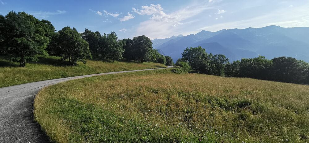
The Maurienne valley is the ideal playground for cyclists
Our land is a mecca for mountain passes! If you want to push yourself, climb hills then descend them, over and over again, then this is the place! Discover our selection, you’ll be amazed…

Ascension du Col du Grand Cucheron
Culminant à 1188 m d’altitude, le Col du Grand Cucheron se situe dans le massif de Belledonne et permet de relier la vallée des Huiles à celle de La Maurienne. Cette ascension offre une vue impressionnante sur le massif de La Lauzière.
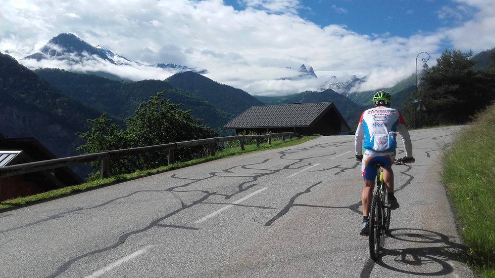
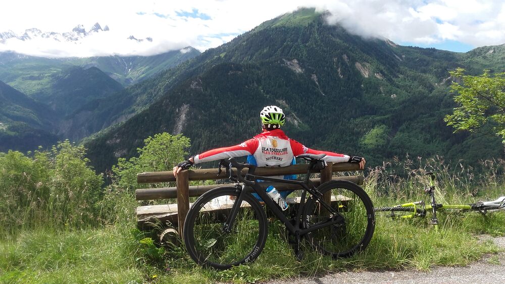
Boucle cyclo : Boucle Toussuire/Corbier
At the end of this long and winding climb you will see two twinned but contrasting resorts, one of which, La Toussuire, has proudly hosted the Tour de France on several occasions.
Boucle cyclo : Circuit de Beau Plan / Boucle de Beaune
This route is much less well known and less frequently cycled than the Col du Télégraphe, just opposite, on the other side of the valley, but it is just as beautiful and just as steep… And the road is much quieter!
Boucle cyclo : Circuit du Chaussy
A circuit that starts via the extraordinary Montvernier hairpins and then continues steeply upwards below the cliffs of Montpascal. The road between the Col du Chaussy and Montaimont finishes on the Col de la Madeleine road.
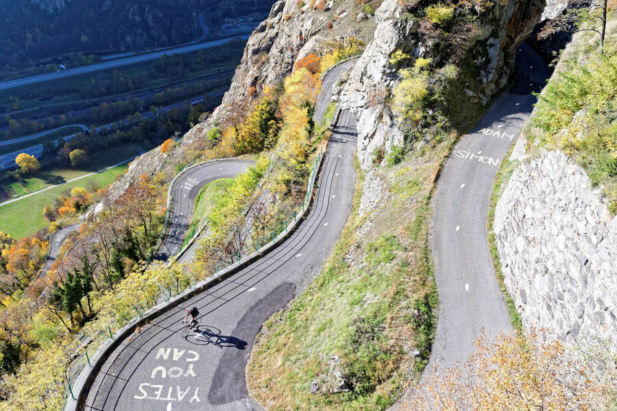
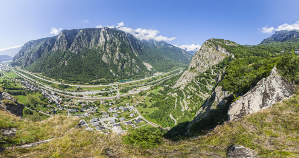
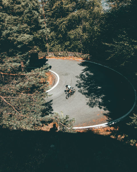
Lacets de Montvernier
Starting from St-Jean-de-Maurienne, follow the Mauriennaise to Pontamafrey. The vertiginous Montvernier hairpins, from where you can see climbers on the neighbouring via ferrata, form one of the most impressive roads in the Alps.
Boucle cyclo : Traversée du Col du Mollard
The traverse of the Col du Mollard can be used to extend the Tour des Albiez. Lying under the watchful gaze of the “Tête de Chat”, the nearest of the three Aiguilles d’Arves, the Col has been made famous by the Tour de France.
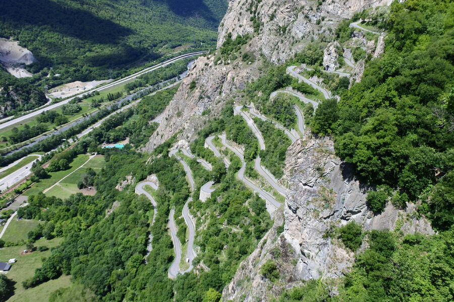
Loop of the laces of Montvernier
The 18 small laces, clinging to the mountain, constitute one of the most spectacular roads in Savoie and a real challenge for cyclists. Nice panorama at the top.
Mauriennaise Loop
A very popular circuit with local cyclists, the Mauriennaise is an excellent way of exploring the countryside and villages of the Lower Maurienne Valley.
Chaussy & Madeleine circuit
This challenging itinerary takes in 2 marvellous passes: le chaussy (1533 m) and la Madeleine (2000 m), while passing through beautiful little villages and the resort of Saint-François Longchamp.
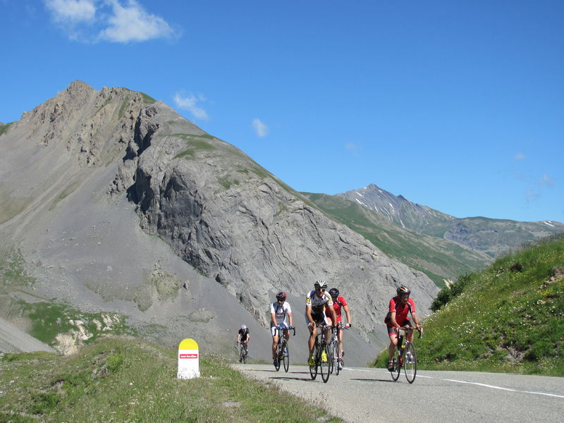
Circuit Glandon/Croix-de-Fer
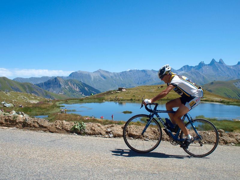
One of the most difficult climbs in Savoie. Treat yourself to a break at one of the cafés in St-Colomban-des-Villards before tackling the final slopes of the Glandon, which largely exceed 10%. Superb views of the Aiguilles d’Arves from the Croix-de-Fer.
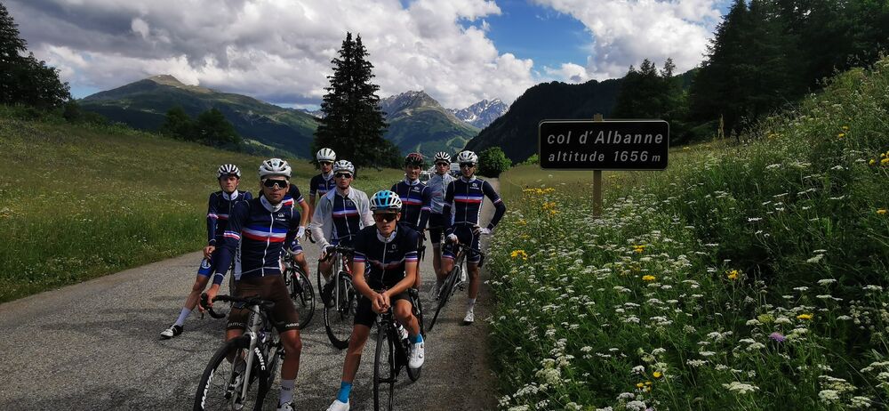
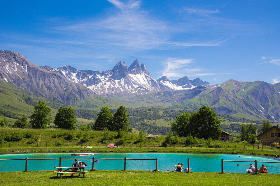
Col d’Albanne and Lake Pramol
Un col méconnu, et pourtant… Ce col est exigeant sur le plan sportif et vous mène dans un havre de paix sur les hauteurs du petit village d’Albanne avec vue sur la majestueuse Croix des Têtes !
Col de la Madeleine via Montgellafrey (variant)
Linking the Maurienne and Tarentaise Valleys, the Madeleine is a must for all road cyclists visiting Savoie. The road via Montgellafrey is the 10th hardest climb in the area. With views of Mont Blanc from the summit, it’s a must for pure climbers.
![Image cucheron [bdef]](https://static.apidae-tourisme.com/filestore/objets-touristiques/images/2/104/1468418-diaporama.jpg)
Col du Grand Cucheron
From Aiguebelle, follow the direction of Saint-Georges-des-Hurtières, then cross the village of Saint-Alban-des-Hurtières. After that, the hardest part of the ascent is coming to reach the Grand Cucheron pass

Col du Mollard via Albiez-le-Jeune
From Saint-Jean-de-Maurienne, enjoy the “lacets” following the direction of the typical villages of Villargondran and Albiez-le-Jeune.
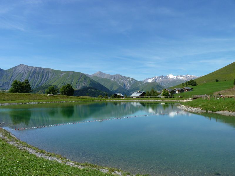
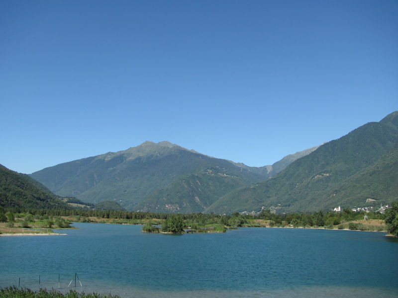
Itinéraire cyclable Lac et villages des Hurtières
Petite boucle au départ du Lac des Hurtières traversant les villages de Saint-Alban et Saint-Georges, agréable plateau ensoleillé face au Massif de La Lauzière. Partez à la découverte de nos villages avec le carnet de jeux Nos Trésors cachés !

Itinéraire cyclable Tour du Col du Grand Cucheron
Cette ascension permet de gravir successivement deux cols, le Grand Cucheron le Champlaurent et ses raides lacets puis le Champlaurent. Ne pas manquer d’admirer les vues sur les Bauges, avec l’impressionnante Dent d’Arclusaz.
Itinéraire cyclable Tour du Grand Cucheron au départ du Lac des Hurtières
Cette ascension permet de gravir successivement deux cols, le Grand Cucheron et ses raides lacets puis le Champlaurent. Ne pas manquer d’admirer la vue sur les Bauges, avec l’impressionnante Dent d’Arclusaz.
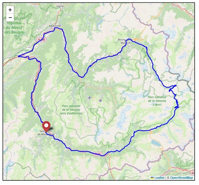
Itinéraire Cyclo : La Haute-Mauriennaise
This long itinerary has several uses: as a route to Italy for passing cyclists, either by taking the train from Modane or cycling over the Col du Mont-Cenis; as a way of getting to the foot of the Col de l’Iseran; or simply to explore the Haute Maurienne!
Itinéraire Cyclo : La Mauriennaise
This route along the valley floor allows you to uncover some of the unsuspected delights of the Maurienne, with its old, secluded villages, its impressive mountainsides and its quiet minor roads.
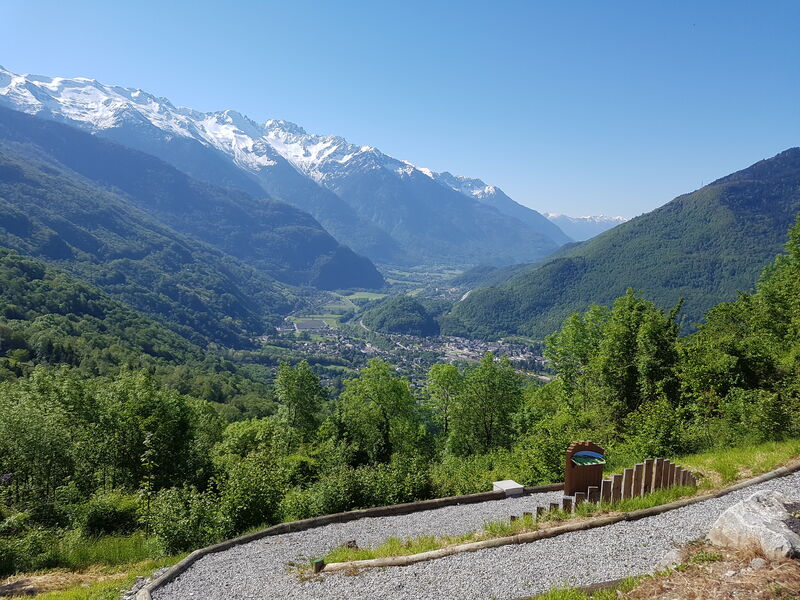
The Maurienn’Ita – Day 2/4 : Saint-Jean-de-Maurienne > Modane by bike
You will cross the heart of the valley before arriving at the gate of Haute Maurienne Vanoise.
La Petite Mauriennaise
This little loop, with its gently undulating profile, will enable you to discover the pretty little villages of the Maurienne, off the main roads.
La Poule au Vélo d’Or – Parcours “La poule”
La Maurienne avec tous ses grands cols, vous attend. Découvrez ce que “La Poule au Vélo d’Or” a imaginé pour vous. Mais n’oubliez pas l’essentiel : profitez de ce que la nature peut vous offrir de plus beau… Alors, prêt à sillonner nos routes ?
La Poule au Vélo d’Or – Parcours “La poule far six”
Entre France et Italie, ce parcours est taillé pour les guerriers ! Au programme, 400km et 10000m de D+… Vous franchirez pas moins de 6 cols situés entre 1924 et 2764 mètres d’altitude. Régalez vous !
Tour of Le Chatel via the Lacets de Montvernier
This pleasant and easy-to-follow circuit takes the famous Lacets de Montvernier. Warning : roadworks this summer 2021. Deviation by motorable path or please get off the bike on the work area and see directly with the workers.
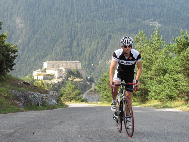
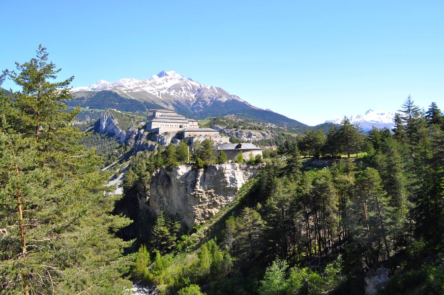
Les Forts de l’Esseillon
This old road to the fortification of L’Esseillon will make you discover many things : waterfall, old forts, beautiful view on the valley and the village of Aussois.
Ascent to Montdenis
This route, rather dizzy during the first part, will offer a beautiful view on the Maurienne valley.
Ascent to Valmeinier 1800
Here is an ideal ascent in the forest to train before climbing the great ‘Col du Galibier’. This rise is nevertheless demanding”.
Ascent to the lake ‘Grande Léchère’
Beautiful climb to wild lake near Saint-François Longchamp.
Lac de Plan d’Aval
This ride takes you past the Rocher des Amoureux, a popular venue for rock climbers, before going through the village-resort of Aussois and up to the reservoir at Plan d’Aval.
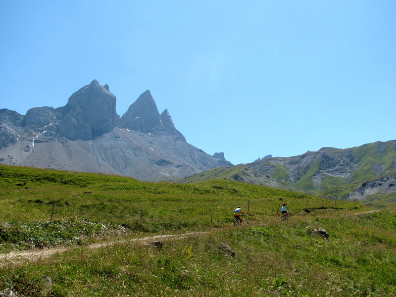
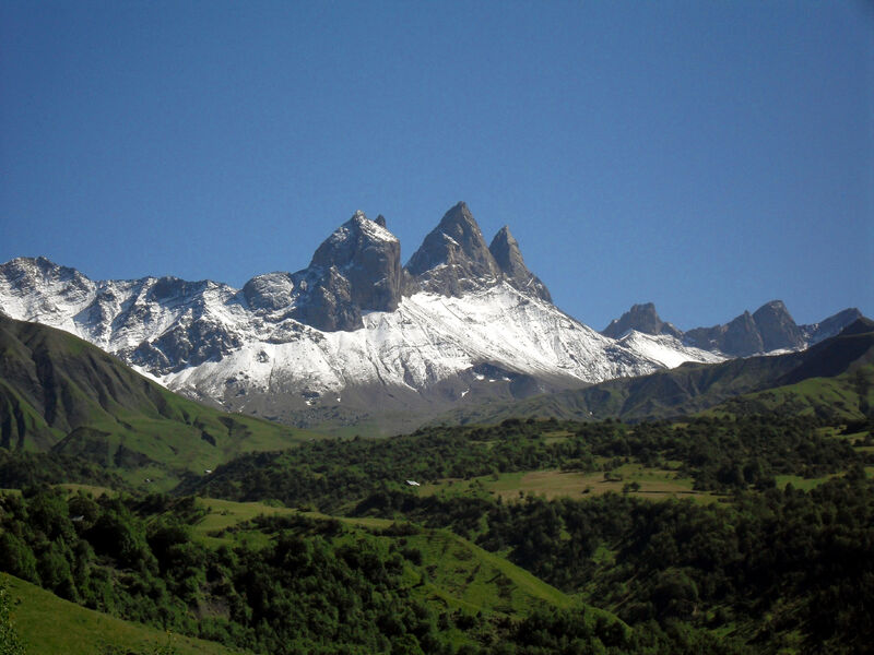
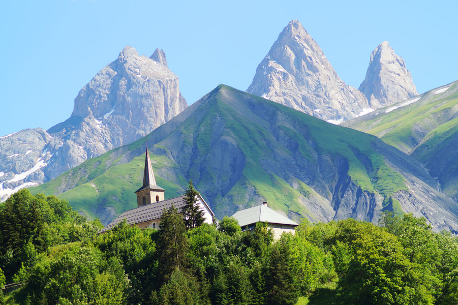
Ascent to Les Aiguilles d’Arves
Harder than the Croix-de-Fer. A 6.6-km section of the switchbacks has an average gradient of 10.3%. Looking towards the Aiguilles d’Arves, it is easy to see why one of them is called the Tête de Chat (cat’s head).
Ascent to ‘Les Karellis’
Itinerary that joins Saint-Jean-de-Maurienne to the ‘Karellis”ski resort.
La Toussuire via Fontcouverte and Le Corbier
This is the variant followed by the Tour de France in 2006. It is fitted with kilometre posts .
Col de la Croix-de-Fer
It is the classic road to make the ascent of Le Col de la Croix de Fer, less hard than by Le Col du Glandon. Discover the high valley of Arves, dominated by the glacier L’Etendard.
Col de la Madeleine from the south
Starting from St Jean de Maurienne, the ride down the valley to La Chambre provides a good warm up. Given its southerly aspect and lack of shade, this climb is best started early on summer days.
Col du Chaussy
The climb starts with the spectacular “Montvernier hairpins”, an improbable road clinging to the edge of the cliff. The upper section goes through several villages and offers panoramic views of the Belledonne Mountains.
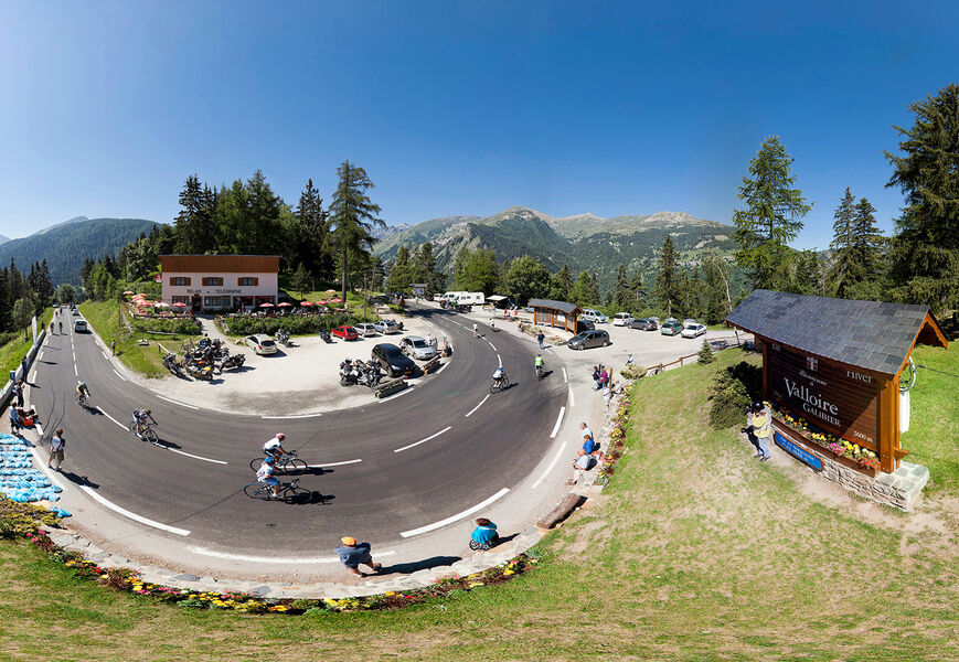
Cycling up the Col du Galibier from Valloire
More than 18 km of high mountain await you to climb this mythical pass and reach a splendidly panoramic finish at 2642 m.
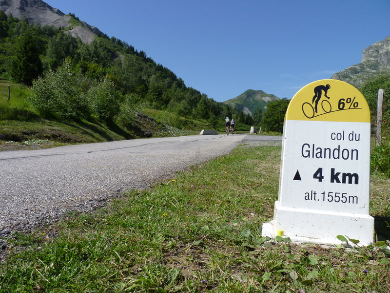
Col du Glandon (East Side)
The Col du Glandon is undoubtedly one of the hardest passes in Maurienne valley. Do not rely on its average 7.2% elevation gain, which hides 3 km of flat in Saint-Colomban-des-Villards and 3 km more than 10% on the last ramps of the col.
Col du Mollard
Un col un peu moins connu que son voisin de la croix de fer mais une ascension non moins redoutable avec ces 17 km à plus de 7% de moyenne.
Cycling up Col du Télégraphe
Most of this climb is in the cool shade of the trees. The gradient eases slightly after the first few kilometres but the slope remains quite steep all the way to the pass and its superb view of the Fort du Télégraphe.
Bonvillard
The climb to the Grand Coin Nordic-ski area is steep and sustained, zigzagging up through woods and clearings towards the surrounding summits. Finishes at Bonvillard.
La Planchette
This climb at the foot of the Croix des Têtes is a haven of peace and quiet. The shady forest, dotted with clearings, continues all the way to the picnic table at the hikers’ car park.
Montée de La Toussuire- Ascension of La Toussuire
Even though, this is not a pass, La Toussuire ascension is still very popular!

Ascent of La Toussuire
From Saint-Jean-de-Maurienne, follow the direction of the Vallée de l’Arvan and La Toussuire. This rise is limited mileage
La Toussuire via Jarrier
A twin to the climb via St. Pancrace, which it joins at Les Bottières. A lovely quiet road to cycle.

La Toussuire via Saint-Pancrace
The climb through St. Pancrace is the hardest of the three roads to La Toussuire. It is often included in the “Trilogie de Maurienne” race, an annual event based around St. Jean de Maurienne.
St Michel 1650 (La Perousaz) via La Porte
This climb exists thanks to a resort that never saw the light of day. As a result, cycloclimbers have inherited a wonderfully peaceful road below the impressive east face of the Croix des Têtes.

Valmeinier
An excellent shady climb on which to train before doing the Galibier. In fact, the route takes in the first part of the climb to the Col du Télégraphe. Cafés and shops at the top.
Le Mollaret via Montgellafrey
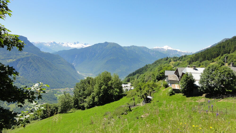
This climb in the foothills of the Lauzière is a good training ride before tackling the Col de la Madeleine. View of the Maurienne Valley and Belledonne Mountains.
The two Albiez churches
From Albiez-le-Jeune to Montrond, travel along the little-used roads of our mountains and their sumptuous landscapes, on the heights of the Arvan valley to link their churches.
Route des Grandes Alpes – Variante par les cols de la Croix de Fer et du Lautaret
Pour ceux qui connaissent déjà le Galibier, pourquoi ne pas choisir au départ de Saint-Michel-de-Maurienne la variante par les cols de la Croix-de-Fer et du Glandon ? Un itinéraire qui vous fera découvrir les vallées de l’Oisans.
Circuit of Arvan-Villards
This route links up 3 legendary Tour de France passes: the Glandon, the Croix de Fer and the Mollard.
Gateway to the Maurienne
A nice and rather easy circuit to discover the entrance of Maurienne valley away from main roads.
Tour of Bonvillaret from Aiguebelle
A rarely cycled route through the Lower Maurienne and the Combe de Savoie.
Circuit of the “Vallée du Bugeon” – starting from La Chambre
This very quiet road to the Col de la Madeleine runs through the little-known Bugeon Valley.
Circuit of ‘Esseillon’
A circuit that group some Haute-Maurienne villages and circles the amazing fortification of L’Esseillon.
Circuit ‘Les Balcons de l’Arvan’
Circuit that connects all villages of Arvan valley
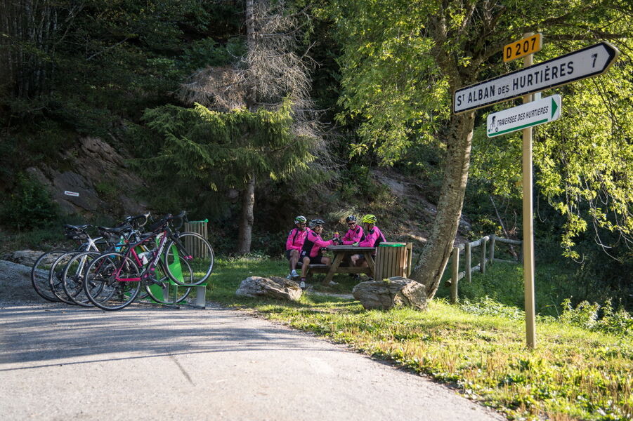
Tour des Hurtières
This varied circuit through the beautiful Vallée des Huiles and Val Gelon is particularly pleasant in summer, as a large part of it is very shady.
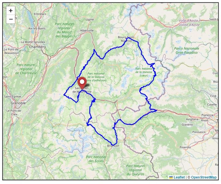
Vialps, cross-border route between Maurienne, Hautes Alpes and Italy in 4 days by bike
Vialps, with its 4600m of D+, is an extraordinary route in the heart of the Alps, following in the footsteps of the Giro d’Italia and the Tour de France. To be completed in one or more days